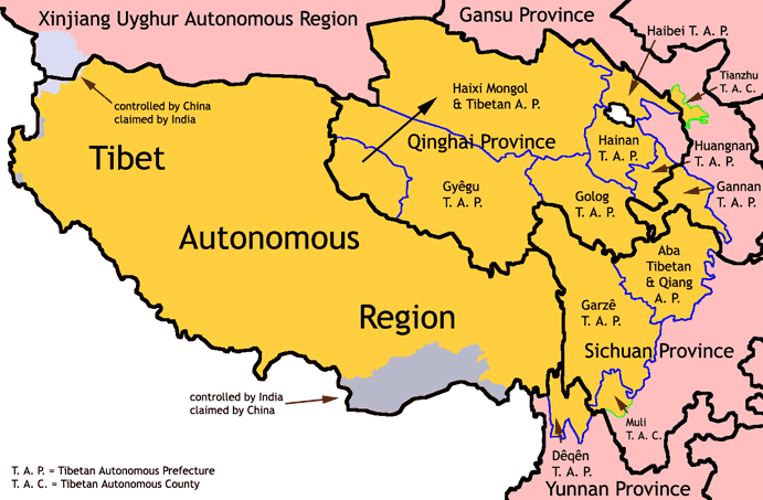
Ethnic Tibetan areas encompass a space much larger than the Tibet Autonomous Region. The map above shows all of the ethnic Tibetan entities (including the Tibet Autonomous Region and all Tibetan Autonomous Prefectures and Counties) set up by the People’s Republic of China.

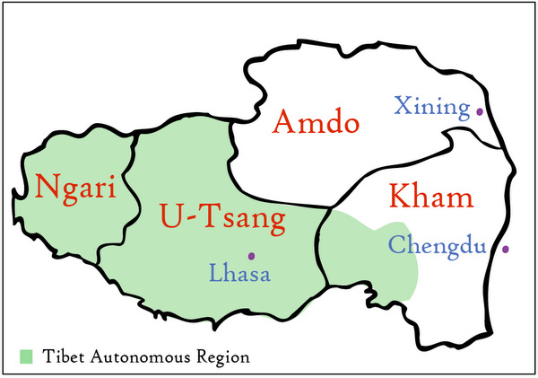
From a Tibetan perspective, Tibet is divided into four regions: Amdo, Kham, U-Tsang, and Ngari. Each region is unique in its culture, religion, language, and geography. Amdo is known for its nomadic grasslands, poets and scholars. Kham is famous for its tough warriors and lively horse festivals. U-Tsang is home to the cradle of Tibetan civilization as well as the barren lands of the Changtang. Ngari, the highest and most sparsely populated region of Tibet, is the site of Mt. Kailash and the ruins of the ancient Guge Kingdom.
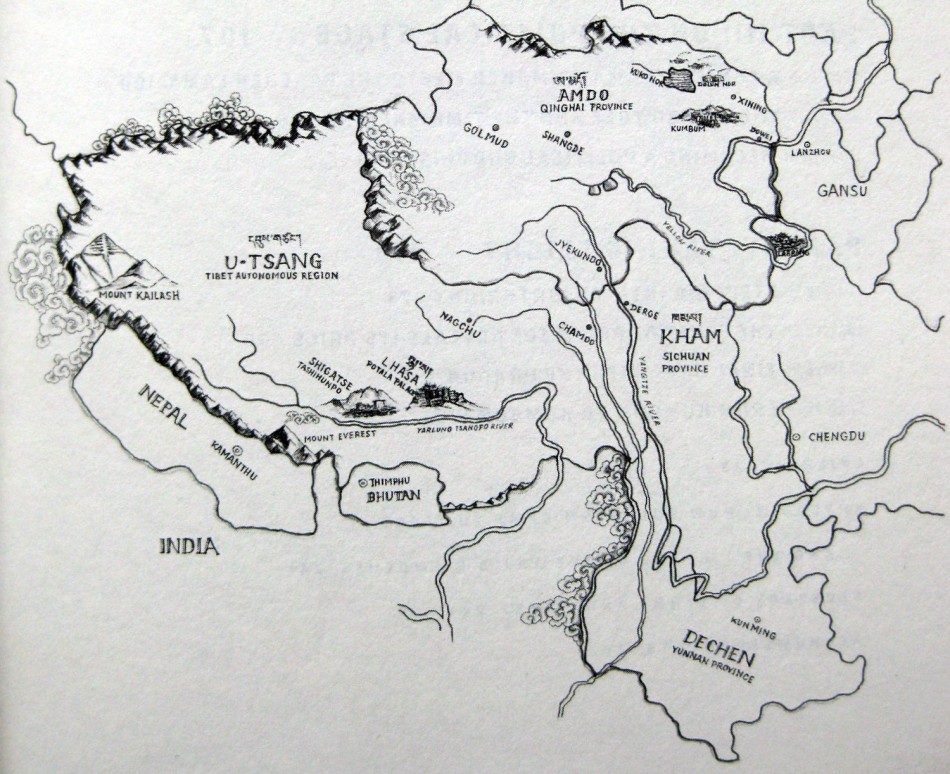
This hand-drawn map marks the traditional regions of Tibet (U-Tsang, Kham, and Amdo) in addition to where they exist in approximate relation to Chinese provinces (U-Tsang in the Tibet Autonomous Region, Amdo in Qinghai, and Kham in Sichuan). Major Tibetan cities, including Lhasa, Shigatse, Nagchu, Chamdo, Jyekundo, Dege, and Golmud, are marked, as are the biggest gateways into Tibetan areas: Xining, Chengdu, and Lanzhou. Important monasteries, such as the Potala Palace in Lhasa, Tashilunpo in Shigatse, Kumbum in Xining, and Labrang in Gansu, are drawn in, as are natural sites like Mt. Everest, Mt. Kailash, and Kokonor (Qinghai Lake).
For more maps, see our Tibet Autonomous Region Maps page and Qinghai Province Maps Page
