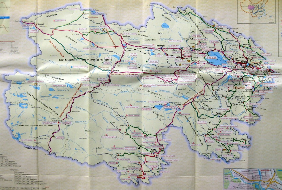
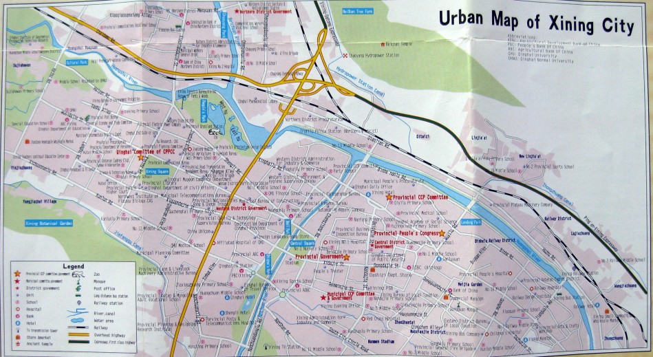
Qinghai Province, which is located in northwestern China, borders the Tibet Autonomous Region and is home to many ethnic minorities, including Tibetans, Hui Muslims, Mongolians, Tu, and Salar. Its capital, Xining, is the gateway to the Amdo Tibetan region. In this region, there are many rolling grasslands, famous monasteries, holy snow mountains, and precious lakes. See the maps below for an overview, and click to enlarge.


June 23rd, 2012at 4:29 pm(#)
[…] For more maps, see our Tibet Autonomous Region Maps page and Qinghai Province Maps Page […]
September 25th, 2014at 7:54 pm(#)
Thanks for publishing this map of Qinghai Province. I live in the UK and I recently visited the province and maps are really difficult to find.
Would it be possible to send me just the section showing Yushu Prefecture? The resolution is not so good on the provincial map.
Hope to hear from you.